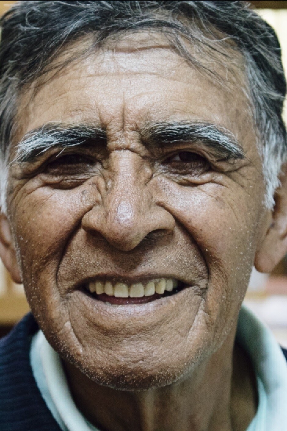
Medical Ministry International in Bolivia

A young nun was so impressed with Medical Ministry International’s work in Peru after receiving care herself, that she advocated for our presence in Bolivia. In 2003, Medical Ministry International sent the first project team to this country.
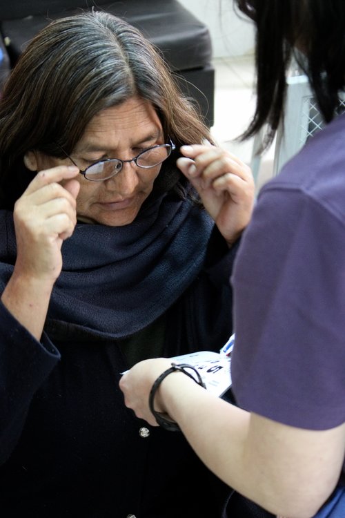
Health Centre - MMI Bolivia
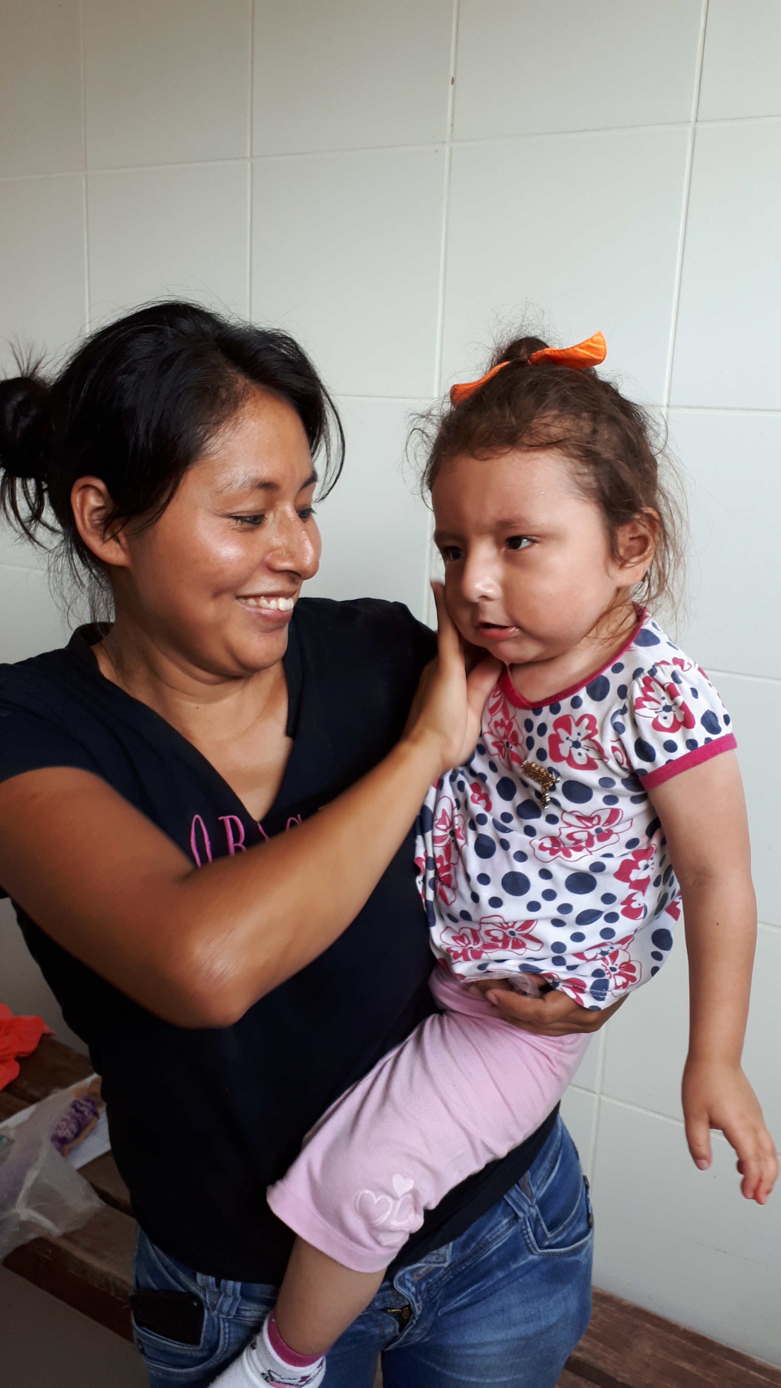
The MMI Bolivia Team responded to the increasing need for specialized medical services within the population currently living on $7.00 or less per day by establishing their first hospital facility. The hospital will be the base for other ministry operations within the country, including two-week project teams.
Phase one of the proposal, which includes purchasing the appropriate land for the facility, is complete. Dr. Jimmy Borda, a Bolivian Ophthalmologist, has completed his residency and retina fellowship with the MMI Partner Health Center, Elias Santana Hospital, in the Dominican Republic.
Phase two will see Dr. Borda serving patients at a temporary facility with donated and purchased equipment alongside a full-time optometrist and dentist who are committed to serving with MMI Bolivia. During this time, MMI Bolivia/Siloam Group Ltd will be reviewing and defining desired services for a fully operational hospital.
Phase three will see the Medical Ministry International Team serving in a fully constructed and equipped hospital facility with the goal of seeing 100,000 patients annually at the hospital and on project teams.

Project Sites:
Camiri
Camiri is on the banks of the Parapeti River in a small valley surrounded by rolling hills on the east, north, and south, and by the Aguarague mountain range on the west. Camiri is a very dry and desolated area with very little economic activities. The population is spread out in many communities where the access is very difficult not only because of the distance but for the condition of the roads.
* Project Description: These projects are intended to provide medical/dental/eye care and preventive care in rural areas of the county where access is very limited. The incidence of STDs, HIV and AIDS is a growing and raising concern among the healthcare workers.We will also help build capacity in this community by training those who partner with us on the field. The kind of training done will be related to the identified needs of the communities. These trainings are always very well received by the medical personnel in the area.
Elevation
300m (984 ft)
Climate
On average, the temperatures are always high.

Ixiamas, Rurrenabaque, La Paz
Ixiamas is a rural community located in the “Cordillera Central,” northwest of La Paz. In this area, the inhabitants work on the farms and families most often live on the income of one person, which averages $5.00 a day. This represents less than the amount per/person that describe the extreme poverty line.
Traditionally, this community will only recieve a doctors visit in the case of an emergency. Ixiamas has a 1st level hospital with several services, but the community often struggles to afford care and medication.
* Project Description: This is an extreme project due to the conditions of the lodging, which is in tents, and the rough traveling. An in-country flight is needed to access Ixiamas and the cost will be about USD $ 270 - 300 and can be arranged by us in-country. This Project will supply the need for healthcare in the community of Ixiamas and neighboring rural areas. A Medical and Dental clinic is usually held from 8:00am to 5:00pm and our hosts will likely be the Bible Church of Mallasillas. Our team will stay at a central base in Santa Cruz and will be traveling to the communities each day.
Elevation
258 m (846 ft)
Climate
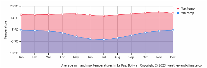
Lake Titicaca
Lake Titicaca is a large, deep lake in the Andes on the border of Bolivia and Peru. By volume of water and by surface area, it is the largest lake in South America. The Lake Titicaca Region is a very populated region around the lake in La Paz, which includes the iconic “Isla del Sol”. The lake is on the border of Peru and Bolivia.
Even with the great tourist industry in the area, the distribution of the wealth remains within a few families possession. Therefore, poverty is still an issue for much of the population. In some communities, there are health posts in which people may have access to a consult with the doctor. Even so, filling a prescription can occur rarely. The need for dental services is also great.
* Project Description: MMI sends Medical and Dental Project Teams to the Lake Titicaca Region that is intended to provide care to people who otherwise have no or limited access to those kind of services in the country. On these projects, MMI works alongside the evangelical churches of the Region, moving to different communities each or every other day. We may also work on one of the islands. A day of clinic is organized mainly in church building or schools. Two to three portable dental units are available for use. We will also help build capacity in this community by training those who partner with us on the field. The kind of training done will be related to the identified needs of the communities. These trainings are always very well received by the medical personnel in the area.
Elevation
3,812 metres (12,507 ft)
Climate
La Guardia
La Guardia is a town of 50,000 in the Santa Cruz area of Bolivia. La Guardia is a rural, impoverished community located 30 minutes west of Santa Cruz. In this area, the inhabitants usually work on the farms and large families live with the income of one person, averaging $5.00 a day. This number represents less than the amount/person that describes the extreme poverty line. Typically, the people in the area only visit the doctor in the case of an emergency. La Guardia has a 2nd level hospital with some services, but the community often struggles to afford medication.
* Project Description: These projects are intended to serve in the area of La Guardia and neighboring communities. The main focus will be preventive work, accomplished in the modality of day clinics hold both in schools and church buildings. Medical and Dental clinics are usually held from 8:00am to 5:00pm. The teams stay at a central base in Santa Cruz and will be traveling to the communities each day.
Elevation
506m (1660 ft)
Climate
On average, the temperatures are always high.
Los Tajibos
Los Tajibos is a rural community located 3.5 hours west of Cotoca. In this area, the inhabitants are clay makers and most families live with the income of one person, averaging $5.00 a day. This represents less than the amount per/person that describe the extreme poverty line.
Traditionally, people will only visit a doctor in the case of an emergency. Los Tajibos has a health center with a physician that visits once a week, and there is currently no dentist available in the region. The dentists located in Cotoca are quite expensive for their present economy.
* Project Description: These projects are intended to continue building capacity in Los Tajibos and Moliendita. Medical and Dental clinics are usually held from 8:00am to 5:00pm. The teams stay at a central base in Santa Cruz and travel to the communities each day. The focus will be preventive work, accomplished in the modality of day clinics hold both in Los Tajibos and Moliendita.
Elevation
189m (620 ft)
Climate
On average, the temperatures are always high.
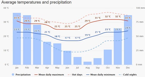
Mineros/Norte Integrado
Norte Integrado and Mineros is region with a 100,000 people and located 1 to 1 ½ hours north of Santa Cruz. Agriculture and fishing are the two main economical sources of income, and the land is mainly owned by a few families with the rest working for them. This is a very impoverished area where the majority of the population coming from the highlands and high plains. The region is also well known by the Sugar factories located just outside of town. The Municipality, knowing about the work of MMI, decided to invite us to collaborate with the vision for the community.
* Project Description: The Mineros Project is intended to provide medical, optometry, artificial eyes, and dental services to the most needed inhabitants of Obispo Santisteban Province. Medical and Dental services will be provided in five different Health Centers. Surgery will be performed at the main hospital, which has a functioning OR. The teams also provide training to the health care workers of the hospital and Health Centers. .
Elevation
373 m (1224 ft)
Climate
The average August temperature ranges from a high of 31°C (88°F) to a low of 20°C (68°F)
On average, the temperatures are always high.
Montero
Montero is located 1 hour north of Santa Cruz, with a population of about 110,000 people. Montero has experienced growth in recent decades, becoming an important city in this region.
Agriculture and fishing are the two main economical sources of income, with the land mainly owned by a few families with the rest working for them. The area produces soybeans, cotton, corn, and rice. The region is also well known by the Sugar factories located just outside of town. This is a very impoverished area, and the majority of the population coming from the highlands and high plains.
* Project Description: On these projects, MMI is invited to collaborate with the vision for the community. The project teams provide medical, optometry, artificial eyes, and dental services to the most needed inhabitants of Montero in the Obispo Santisteban Province; as well as to provide training to the Health Care Workers of the Hospital and Health Centers. The incidence of STDs, HIV and AIDS is a growing and raising concern among the healthcare workers.
Elevation
300m (984 ft)
Climate
On average, the temperatures are always high.
Oruro
Oruro or Uru Uru is a city in Bolivia with a population of 264,683, located in the Altiplano about equidistant between La Paz and Sucre.
* Project Description: These projects are intended to provide Medical and Dental care to the people of Oruro. The projects are held in coordination with the Evangelical Churches of Oruro. Clinics are most often implemented in churches and school buildings. The teams travel to different communities providing health care, disease prevention, and counseling to the people of Oruro. These projects should provide 800 medical consults, 100 dental consults, and similar number of dental treatments.
Elevation
3,735 m (12,254 ft)
Climate
Portachuelo
Portachuelo is the capital of the province of Sara in the north of Santa Cruz. It is one of the poorest and smallest counties. The main industries are cattle and agriculture. There is one general practice physician per 2700 people.
* Project Description: The teams work in a rural areas of the province, which are still part of Portachuelo but not downtown.
Elevation
298m (978 ft)
Climate
On average, the temperatures are always high.
Roboré
Roboré is a small town located in the Province of Chiquitos, 4 hours from Santa Cruz. This is one of the many communities where the Jesuits Missions stablished their work in Bolivia. Important tourist attractions are in this county. Even though the region is very popular in tourism, poverty is considered extreme in most of this community. The Municipality of Roboré, knowing about the work that MMI is doing in the country, contacted us to come along side with the with the main purpose of meeting the need for medical services as well as the need for training among their personnel.
* Project Description: The Roboré Project is intended to provide medical, dental, and surgical services to the most needed inhabitants of the Chiquitania Region; as well as to provide training to the Health care Workers of the Hospital and Health Centers.
Elevation
256m (839 ft)
Climate

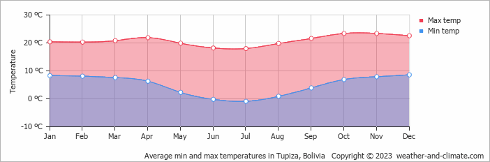
Samaipata-Mairana
Samaipata and Mairana are two of the Municipal Sections of the Florida Province, in the southwest of Santa Cruz. Samaipata and Mairana are rural areas where agriculture plays a very important role in the economy. The population is spread out in many communities where the access is very limited, due to distance and poor road conditions. Basic medical and dental care in this region are available, but very limited. The number of preventable diseases is considerably growing.
* Project Description:The Samaipata and Mairana Project is intended to provide preventative health, medical, and dental care to people with limited or no access to these services. The team sets up clinic at different sites around Samaipata and Mairana, and the location for clinic sites vary between church buildings, community centers, health facilities, and public parks.
This project will also provide a training opportunity for those who are serving in the medical field. Volunteer Doctors and Nurses will be lecturing on different topics related to the identified needs of the communities and training those who partner with us on the field. These trainings have been very well received by the medical personnel in the area.
Elevation
1600–1800 m (5200-5900 ft)
Climate
The climate is temperate, semi-dry in the winter months, and mild with an average annual temperature of 19.9 °C. The winter months can come with cold winds, and combined with the altitude, temperatures can reach below freezing. In the summer, the days are warm and the nights cool.
San Carlos
San Carlos is the Capital County of the Province of Ichilo in the north of Santa Cruz. It is one of the poorest Counties in the State of Santa Cruz. It has 25,000 people spread in the main town and other districts. The main activity is agriculture; they grow oranges, rice, and cocoa. The land is mainly owned by a few families and the rest of the population work for them. The county is also rich in sand and clay used in construction.
In San Carlos, there is one General Practice Physician per every 3,200 inhabitants. There are 3 Dentists, 2 OB-GYN doctors, 1 General Surgeon, 1 Pediatrician and 1 Radiologist (working half time) for the whole population. Ongoing prevention programs are not available and the number of preventable diseases is increasing considerably.
* Project Description: The San Carlos’ Medical, Dental, Surgical Projects are intended to provide medical care to the those with no or limited access to those services in the county. The hospital does not have enough personnel or supplies to provide for the demand. The MMI teams have been helping with the backlog of surgical cases, and supplying the need for Dental services, Optometry, and general healthcare.
Elevation
345m (1131 ft)
Climate
On average, the temperatures are always high.
San Juan
San Juan is an impoverished community in the state of Santa Cruz located in the lower side of the Yapacaní River. Most of the 26,0270 inhabitants spread throughout the main town and other communities make a living through agriculture, growing rice, cane sugar, and mandarine oranges.
The Yapacaní River causes a lot of flooding during the rainy season. There is so much rain that most of the communities we serve have been isolated due to the flooding. These waters can cause skin conditions, intestinal infections, and respiratory conditions reducing the villagers ability to work.
Elevation
334 m (1096 ft.)
Climate
On average, the temperatures are always high.
Santa Rosa
Santa Rosa is one of the poorest Counties of the States of Santa Cruz. It has 25,000 people spread in the main town and 10 other districts. The main source of work is in agriculture, growing oranges, bananas, rice, and beans. The land is mainly owned by a few families and the rest of the people work for them. The county is also rich in natural gas.
* Project Description: On the Surgical, Medical, and Dental projects, services are usually provided in clinics in the region and surgery is performed at the main hospital. This project provides patients with the opportunity to have access to a surgery in their own community for an affordable cost. Another goal is to train local partners and continue building capacity within their health care system.
Elevation
270 m (886 ft.)
Climate
On average, the temperatures are always high.
Sucre
Sucre is the capital of the State of Chuquisaca. It has 500,000 inhabitants spread in the main town and other districts. The main line of work is in agriculture, growing corn, vegetables, and fruits. The land is mainly owned by a few families and the rest of the people work for them. The county is also rich in natural gas and oil.
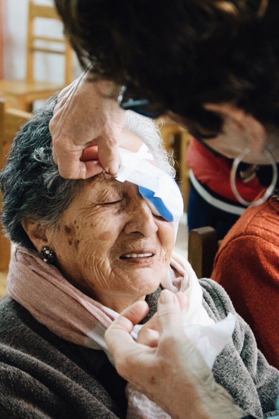
Chuquisaca continues to be one of the neediest States in regards to Ophthalmology. The number of surgical cases continues to increase. Many people we serve are not able to purchase glasses when prescribed due to low income.
* Project Description: The purpose of these projects have been to provide an opportunity to those suffering of preventable or curable diseases, as well as interchange knowledge with the local Ophthalmologists in the area. Another focus has been to continue training local Ophthalmologists who want to be trained in small incision cataract surgeries. We aim to strengthen the links and bonds with the University of Sucre and the Ministry of Health and to identify potential sites for the establishment of an eye Clinic in the area.
Elevation
2,810 meters (9,214 feet)
Climate
Cool temperate climate year-round.
On average, the temperatures are always high.
Tarija
Tarija is the capital of the State of Tarija. It has 250,000 inhabitants spread in the main town and other districts. The main activity is agriculture, growing mainly grapes, peaches, and garlic. The land is mainly owned by a few families and the rest of the people work for them. The county is also rich in natural gas and oil.
Tarija continues to be one of the neediest States in regards to Ophthalmology. The number of surgical cases is consistently increasing. Much of the community is not able to purchase glasses when prescribed due to low income.
* Project Description: These projects focus on clinical, surgical, and vision care, as well as the interchange of knowledge with the local Ophthalmologists in the area.
Elevation
1,853 m (6,083 ft.)
Climate
The months October, November, and December have mild weather and temperature.
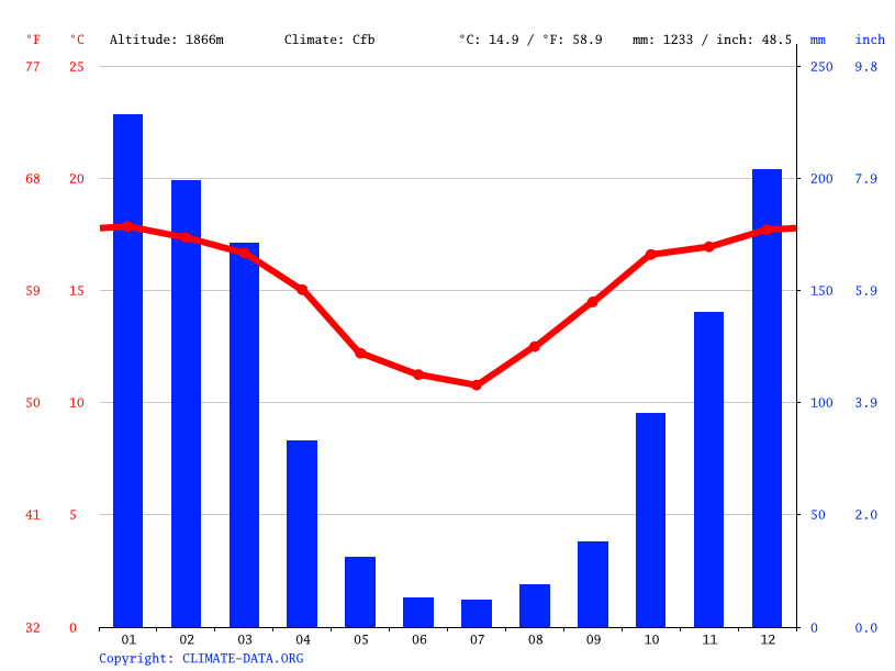
Uyuni & Potosí
Potosí is the capital of the department of Potosí in Bolivia. It is one of the highest cities in the world by elevation at a nominal 4,090 meters (13,420 Ft.) and it was the location of the Spanish colonial mint.
Uyuni is 213km from Potosí. It has an approximate population of 52000 inhabitants. The desert has a surface area of 10582km2. It is the largest salt desert of the world. It also has colorful volcanic mountains that reach altitudes of 6000 meters above sea level.
* Project Description: These Medical/Dental projects aim to bring health assistance to different locations each day, working with churches, health centers, and schools.
Elevation
3,656 m (11,995 ft)
Climate
Average temperature in November ranges from 40°F to 69°F.
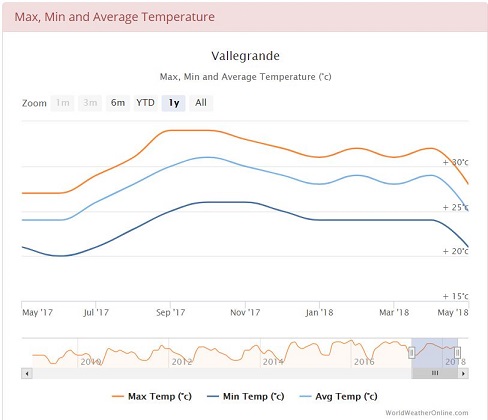
Vallegrande
Vallegrande, Spanish for "Big Valley", is a small colonial town in Bolivia, located in the Department of Santa Cruz, around 125 km southwest of Santa Cruz de la Sierra. The town has approximately 6,000 inhabitants. It has a mild temperate climate due mainly to its valley location, altitude, and the cold winter fronts the sweep the plains of Santa Cruz known as "Surazo". It serves as a regionally important market town. The small town is best known for being the first burial site of revolutionary Che Guevara, after his 1967 execution.
The main industries in the area revolve around agriculture and its derived products. The region is mainly dedicated to the production of grains such as corn and wheat, and fruits such as peaches, apples, grapes, pears, chirimoyas and plums. Among the value added products the most important are homemade bread, chamas, fruit liquor, wine, handmade rugs, and other handcrafts.
Elevation
2,030 m (6,660 ft)
Climate
Vallegrande has a subtropical highland climate.
Warnes
Warnes is a town in Bolivia, named after Colonel Ignacio Warnes, a military leader in the South American war of independence. It is located 24 kilometers north of Santa Cruz de la Sierra. The population is approximately 30,000.
Elevation
339 m (1,112 ft)
Climate
Tropical wet and dry climate.
Yapacaní
Yapacaní is a 50,000 people town located in the Province of Ichilos, 2 ½ hours north of Santa Cruz; Agriculture and fishing are the two mail sources of income, being the land mainly owned by a few families and the rest work for them. This is a very impoverished area, where the majority of the people came from the highlands and high plains.
* Project Description: The Yapacaní Projects are intended to provide medical, dental, and surgical services to the most needed inhabitants of the Province of Ichilo. Medical and Dental services will be provided in five different Health Centers. There are three portable dental units that can be transported to remote areas. Surgery will be performed at the main hospital, which has a functioning OR. The teams also provide training to the health care workers of the hospital and Health Centers.
Elevation
295m (967 ft)
Climate
On average, the temperatures are always high.
Travelling on a Project

About Bolivia
COUNTRY BACKGROUND
Bolivia, named after independence fighter Simon Bolivar, broke away from Spanish rule in 1825. Democratic civilian rule was established in 1982. For over a decade Bolivia has had one of the fastest economic growths in Latin America, however it remains one of the poorest countries in South America. Efforts are ongoing to empower the nation’s poor and indigenous people. Spanish is the official and predominant language, although 36 indigenous languages also have official status, of which the most commonly spoken are Guarani, Aymara and Quechua languages. Its main economic activities include agriculture, forestry, fishing, mining, and manufacturing goods such as textiles, clothing, refined metals, and refined petroleum. Bolivia is very rich in minerals, especially tin.
Bolivia is striving to improve its services in several areas of health and development, including poverty, education, malnutrition, mortality, and life expectancy. More children are being vaccinated and more pregnant women are getting prenatal care and having skilled health practitioners attend their births. Bolivia's income inequality is the highest in Latin America and one of the highest in the world. Public education is developing and educational opportunities are among the most unevenly distributed in Latin America, with girls and indigenous and rural children less likely to be literate or to complete primary school. Bolivia's lack of clean water and basic sanitation, especially in rural areas, contributes to health problems. The economy in Bolivia continues to undergo transitions as the country desperately searches for a more self-sustaining system that will release it from its almost complete dependence on traditional global trade models.
LOCATION:
Central South America, southwest of Brazil
TERRAIN:
Rugged Andes Mountains with a highland plateau (Altiplano), hills, lowland plains of the Amazon Basin
GEOGRAPHIC COORDINATES:
17 00 S, 65 00 W
MAP REFERENCES:
South America
TOTAL AREA:
1.099 million km²
BORDER COUNTRIES:
Argentina, Brazil, Chile, Paraguay, Peru
COASTLINE:
0 km (landlocked)
MARITIME CLAIMS:
None (landlocked)
ELEVATION EXTREMES
LOWEST POINT:
Rio Paraguay - 90 m
HIGHEST POINT:
Nevado Sajama - 6,542 m
CLIMATE:
Varies with altitude; humid and tropical to cold and semi-arid
